Credits & rights
Every image, accounted for
1 portrait records
Portrait categories in this edition
- : 7
- : 1
- : 3
- : 5
- : 8
- : 18
11 portraits have been upgraded with verified source originals and item-level evidence. No category implies another: “no known restrictions” is an institutional statement, not a public-domain finding.
Agency and institutional images
Maintain accurate historical context, credit the creator/agency, preserve source records and avoid implying subject or agency endorsement.
NASA, National Park Service, U.S. Air Force and Library of Congress images are used for factual educational biography profiles. Their use does not imply endorsement by any agency or by the people shown. No promotional, merchandise or separate personality-rights clearance is asserted. These limits do not prevent the identified factual educational profile use.
Evidence reviewed 2026-11-08.
Provenance
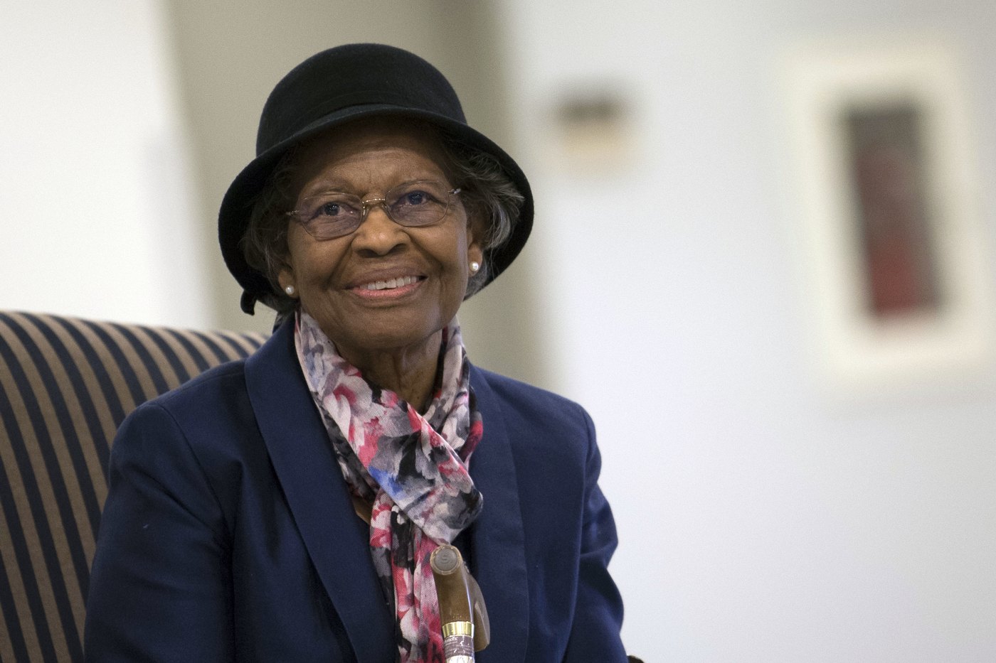
Gladys West
- Kind
- Historical photograph
- Title
- Gladys West at her Air Force Hall of Fame induction, December 6, 2018
- Credit / creator
- Adrian Cadiz / Secretary of the Air Force Public Affairs, 181206-F-DT527-087 (2018).
- Source page
- https://www.spoc.spaceforce.mil/Multimedia/Photos/igphoto/2002069983
- Original file
- https://media.defense.gov/2018/Dec/06/2002069983/-1/-1/0/181206-F-DT527-087.JPG
- Local cache
/media/portraits/gladys-west.jpg+ responsive WebP copies (resized; original stays at source)- Original date
- See credit
- Quality
- Unresized source file retained; highest-resolution version obtained from the inspected source, not a claim that no larger archival master exists.
- Source size
- 5568 × 3712 px
Permission
Source-declared public domain
Recorded statement: “Public domain in the United States, supported by the original photograph’s explicit Public Domain IPTC rights field and Secretary of the Air Force Public Affairs creator/credit metadata. Historical educational reuse is supported; retain attribution and the agency non-endorsement notice.”
Rights evidence: https://www.dvidshub.net/about/copyright
Item evidence (checked 2026-11-08):
- Original JPEG IPTC ObjectName: 181206-F-DT527-087; By-line: Adrian Cadiz; By-line Title and Credit: Secretary of the Air Force Public Affairs; Copyright Notice: Public Domain.
- The retained original SHA-1 exactly matches the Commons original file record: d2e55c5d5b812365adc7295fb4ba1bb9afc382b5.
- Commons links the same official agency source and states official-duty Air Force public-domain status; the original embedded rights field supplies item-level evidence independent of the Commons label.
Qualification: Item-level Public Domain metadata and federal creator identity resolve this photograph’s copyright basis; no inference that all military-hosted imagery is unrestricted. Official image-detail and media.defense.gov endpoints returned 403 during this check. The full-size original already acquired from the documented Commons mirror was inspected and copied unchanged; no claim of successful new direct agency download.
Scope: Educational biography profile use; not advertising, endorsement or merchandise.
Notice: The appearance of U.S. Department of War (DoW) visual information does not imply or constitute DoW endorsement.
Reviewed 2026-11-08. Category summarizes the source statement; not a legal determination.
Contextual media register
1 of 13 reuse-supported contextual items for this figure. Local copies are optimized WebP derivatives; the original-quality file stays at its source.
Provenance
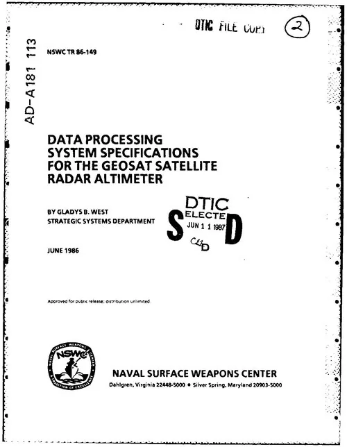
Gladys West’s own satellite-data report
Date: 1986-06 · Creator: Gladys B. West, Naval Surface Weapons Center
Credit: Gladys B. West / Naval Surface Weapons Center, NSWC TR 86-149 (1986); scan via Wikimedia Commons.
Figure: Gladys West
Source size: 500 × 644 px
Permission
Public domain in the United States: work of the federal government.
Commons identifies the report as a federal employee’s official work under 17 USC 105. Title page confirms author, federal institution, June 1986, and approval for public release.
Editorial: The authentic title page is PDF page 3; the first two pages are microfiche/calibration material. This is a 500-pixel web preview, suitable for a small contextual card. It is evidence of West’s research, not a patent for inventing GPS alone.
Partner logos
Exact approved files supplied by the partners; displayed unmodified with preserved proportions.

Black Muze Global Network
1024×358 PNG · verified 2026-11-08 · used with partner approval
Gold full horizontal mark; use against black/dark background. Keep clear space at least the GLOBAL NETWORK text height.

Obsidian Solutions
1024×1024 PNG · verified 2026-11-08 · used with partner approval
Full stacked mark including SOLUTIONS; use on dark quiet background, with clear space at least 15% of logo width. Preserve all elements and purple glow.

Pedagogy Muse
1024×430 PNG · verified 2026-11-08 · used with partner approval
Character and open book with green PEDAGOGY/red MUSE text. Prefer white or very light background for readable brand name. Keep character and book together, preserve colors and aspect ratio.
Data sources
- U.S. Census Bureau — 2026 National Places Gazetteer
Representative point of a modern Census place; not historical address or necessarily geometric centroid. Documentation - U.S. Census Bureau — 2026 National Counties Gazetteer
Representative point of a county; coarser accuracy than city-level data. Documentation - GeoNames — United States and Puerto Rico postal-code data · CC BY 4.0
Estimated WGS84 postal locality coordinates; GeoNames accuracy flags retained; not USPS-certified ZIP boundaries. Postal-code coordinates: GeoNames, CC BY 4.0. Modified into a ZIP lookup table. Documentation - U.S. Census Bureau — 2026 National County Subdivisions Gazetteer
Representative point of a modern township; used for Montclair, New Jersey. Documentation - GeoNames — San Francisco populated-city point (5391959) · CC BY 4.0
Populated-city point, replacing the Census representative point for San Francisco municipal territory including offshore islands. San Francisco city coordinate: GeoNames, CC BY 4.0. Documentation - OpenStreetMap map tiles © OpenStreetMap contributors (ODbL).