Credits & rights
Every image, accounted for
1 portrait records
Portrait categories in this edition
- : 7
- : 1
- : 3
- : 5
- : 8
- : 18
11 portraits have been upgraded with verified source originals and item-level evidence. No category implies another: “no known restrictions” is an institutional statement, not a public-domain finding.
Agency and institutional images
Maintain accurate historical context, credit the creator/agency, preserve source records and avoid implying subject or agency endorsement.
NASA, National Park Service, U.S. Air Force and Library of Congress images are used for factual educational biography profiles. Their use does not imply endorsement by any agency or by the people shown. No promotional, merchandise or separate personality-rights clearance is asserted. These limits do not prevent the identified factual educational profile use.
Evidence reviewed 2026-11-08.
Provenance
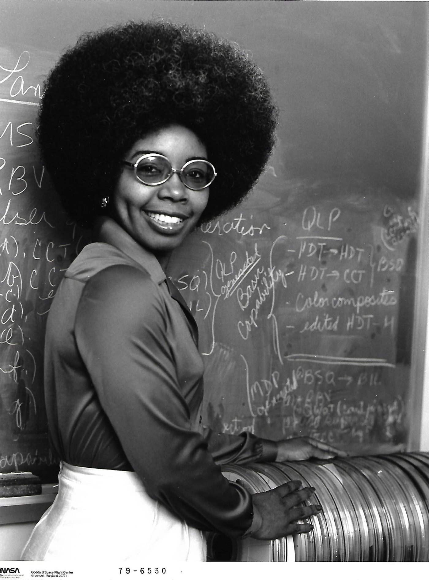
Valerie Thomas
- Kind
- Historical photograph
- Title
- Valerie Thomas with Landsat computer-compatible tapes, 1979
- Credit / creator
- NASA Goddard Space Flight Center, photograph 79-6530 (1979).
- Source page
- https://science.nasa.gov/missions/landsat/a-face-behind-landsat-images-meet-dr-valerie-l-thomas/
- Original file
- https://assets.science.nasa.gov/content/dam/science/missions/landsat/2019/02/ValerieThomas-LandsatImageProcessing.png
- Local cache
/media/portraits/valerie-thomas.jpg+ responsive WebP copies (resized; original stays at source)- Original date
- See credit
- Quality
- Unresized source file retained; highest-resolution version obtained from the inspected source, not a claim that no larger archival master exists.
- Source size
- 1570 × 2120 px
Permission
Reuse supported by agency terms
Recorded statement: “Factual educational/editorial reuse supported by NASA’s image guidelines; the exact historical photograph is explicitly credited to NASA in its image article.”
Rights evidence: https://www.nasa.gov/nasa-brand-center/images-and-media/
Item evidence (checked 2026-11-08):
- NASA’s February 10, 2020 image article identifies this 1979 tapes photograph and explicitly gives Image Credit: NASA.
- The original scan visibly identifies NASA Goddard Space Flight Center and photograph number 79-6530.
- No third-party creator, copyright notice or credit appears on the inspected item pages.
Qualification: Item-specific NASA authorship plus explicit NASA educational-use terms supports this profile use; no claim that every NASA-hosted photograph is federal.
Scope: Educational biography profile use; not advertising, endorsement or merchandise.
Reviewed 2026-11-08. Category summarizes the source statement; not a legal determination.
Contextual media register
1 of 13 reuse-supported contextual items for this figure. Local copies are optimized WebP derivatives; the original-quality file stays at its source.
Provenance
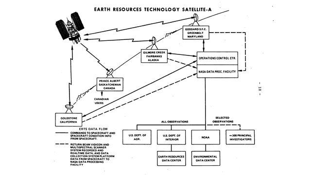
How early Landsat data reached people
Date: Undated historical diagram; NASA gallery updated 2025 · Creator: NASA
Credit: NASA, Earth Resources Technology Satellite communications diagram.
Figure: Valerie Thomas
Source size: 1920 × 1080 px
Permission
NASA educational/informational reuse supported; federal NASA image with no third-party credit.
Item credits NASA. NASA media guidance permits factual educational and informational use with acknowledgment and without implied endorsement; no third-party rights notice shown on item.
Editorial: Program context, not a drawing claimed to be made by Thomas. Her role is independently supported by NASA’s interview. Preserve diagram aspect ratio and offer enlargement; do not claim this diagram or entire Landsat system as her sole invention.
Partner logos
Exact approved files supplied by the partners; displayed unmodified with preserved proportions.

Black Muze Global Network
1024×358 PNG · verified 2026-11-08 · used with partner approval
Gold full horizontal mark; use against black/dark background. Keep clear space at least the GLOBAL NETWORK text height.

Obsidian Solutions
1024×1024 PNG · verified 2026-11-08 · used with partner approval
Full stacked mark including SOLUTIONS; use on dark quiet background, with clear space at least 15% of logo width. Preserve all elements and purple glow.

Pedagogy Muse
1024×430 PNG · verified 2026-11-08 · used with partner approval
Character and open book with green PEDAGOGY/red MUSE text. Prefer white or very light background for readable brand name. Keep character and book together, preserve colors and aspect ratio.
Data sources
- U.S. Census Bureau — 2026 National Places Gazetteer
Representative point of a modern Census place; not historical address or necessarily geometric centroid. Documentation - U.S. Census Bureau — 2026 National Counties Gazetteer
Representative point of a county; coarser accuracy than city-level data. Documentation - GeoNames — United States and Puerto Rico postal-code data · CC BY 4.0
Estimated WGS84 postal locality coordinates; GeoNames accuracy flags retained; not USPS-certified ZIP boundaries. Postal-code coordinates: GeoNames, CC BY 4.0. Modified into a ZIP lookup table. Documentation - U.S. Census Bureau — 2026 National County Subdivisions Gazetteer
Representative point of a modern township; used for Montclair, New Jersey. Documentation - GeoNames — San Francisco populated-city point (5391959) · CC BY 4.0
Populated-city point, replacing the Census representative point for San Francisco municipal territory including offshore islands. San Francisco city coordinate: GeoNames, CC BY 4.0. Documentation - OpenStreetMap map tiles © OpenStreetMap contributors (ODbL).